Flight of the Bumblebees 2008 - Bob Cunnings NW8L
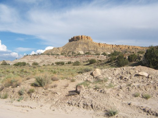
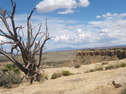
This year - to the desert for FOBB. The location was up on a mesa overlooking the Arroyo Bernalillito area of the Ojito Wilderness northwest of Albuquerque, NM. A narrow promontory juts out northward from the main body of the mesa, with its head standing about 300 feet above the surrounding terrain at an elevation of 6100 feet. This is a great spot for a QRP station and provides a clear shot for signals to the west, north, and east.
Getting up there isn't too difficult if you take your time. The lower portion consists of steep debris slopes, and the uppermost portion a sheer sandstone vertical wall. Fortunately a cleft in the sandstone is located near the operating spot, marked by a gnarly old pinon tree growing out of the rock. A faint, intermittent trail provides a rather tortuous path from the base up to the cleft, and from there a little easy rock climbing gets one to the top. The trick is to avoid starting a rockslide on the unstable slope of decomposed mudstone leading to the caprock.
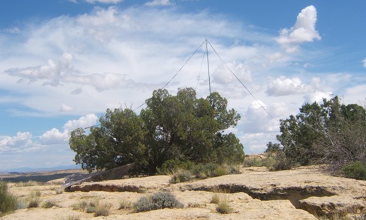
Once on top I set up the antenna. It is made from 64 feet of 450 ohm balanced line. One conductor is opened at the center and connected to the 300 ohm feedline, and serves as directly driven 40 meter dipole. The other conductor is notched out 15 feet in from each end to form a 20 meter dipole centered at the feedpoint, but not connected (the "coupled resonator"). The feedline is 40 feet long and connected directly to KX1, which finds a good match on 30 meters as well as 20 and 40. The feed point was supported by a 32 ft. telescoping fiberglass windsock pole, tied to a juniper tree. Orientation was North/South.
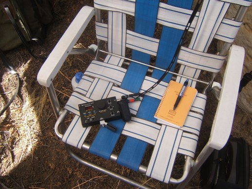
The rig is my trusty Elecraft KX1, with a small self-powered speaker. Power is about 3W on 20 m, 4W on 40 m.
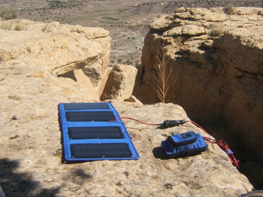
Power was supplied by a 10W solar panel charging a 2AH gel cel.
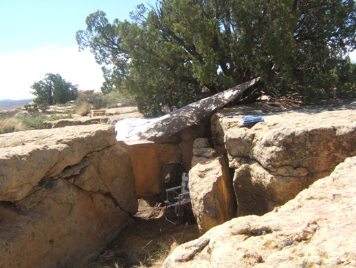
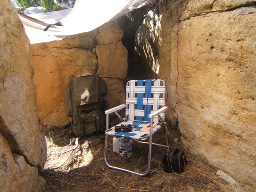
Near the edge the caprock is broken up, and I set up the shack in this cleft under the juniper tree holding up the antenna mast, with a "Noah's Tarp" for shade.
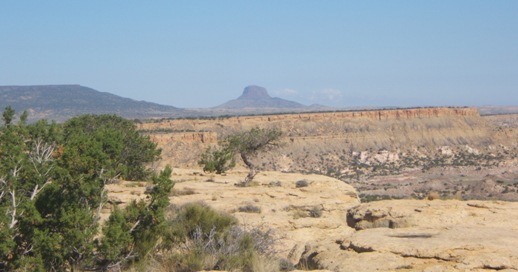
The view to the West, with Cabezon, a volcanic plug, on the horizon.
The view to the North, overlooking the area in the Ojito Wilderness where the dinosaur "Seismosaurus" was excavated. Less than a half a mile in are some nice petroglyphs.
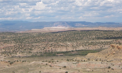
The view to the East looking toward White Mesa, where gypsum is mined to make wallboard. The clouds were building as the day went on, as remnants of Hurricane Dolly were drifting in from the southeast.
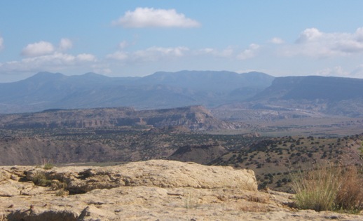
The view to the Southeast. The main body of the mesa can be seen, and Sandia Mountain near Albuquerque is off in the distance.
Ready to go. Conditions were a little better this year, it seemed. I made 46 QSOs, 42 on 20 meters and 4 on 40 meters. 29 were with fellow BBs, and 17 with home stations. It was great to hear more home stations this year, thanks! 20 was the hot band, with some great signals - N7OU, N5GW and K5OT come to mind as being strong at my location. Not all were easy however, and I had to really strain to hear those which were fading in and out. I switched to 40 only at the tail end, even then signals were quite weak here. 21 states were worked: MI, TX, IL, MN, AL, CA, AR, MO, OR, OH, CO, WY, NM, FL, ID, KY, WA, WI, MS, VA, and GA. It was nice to work into the South, but I couldn't raise any stations in New England, although I did hear a few, very faintly.
Once FOBB was done, I packed up and headed down since I wanted to do a little sightseeing in the area and take some pictures before driving home.
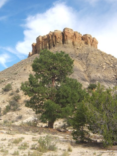
At the bottom there is a tiny relic population of Ponderosa Pines, left over from better (wetter) times. They seem really out of place here.
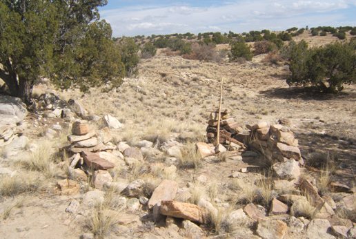
I hiked in about a half mile to the North, near the Seismosaurus site, where there are some old ruins.
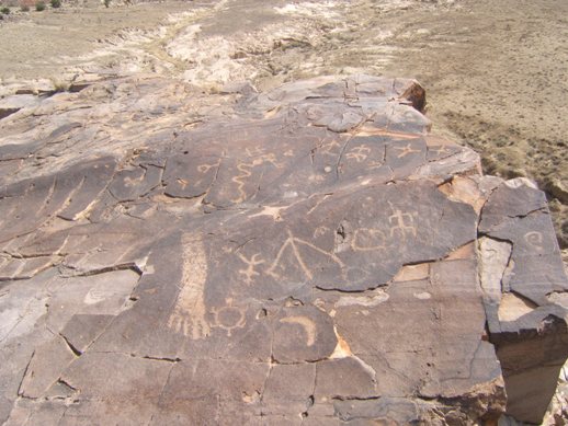
Nearby are some petroglyphs, on horizontal rock at the edge of the Seismosaurus mesa, overlooking the Arroyo Bernalillito area. Human arm, turtle, snake, sun, crescent moon, north star - it's the full catalog!
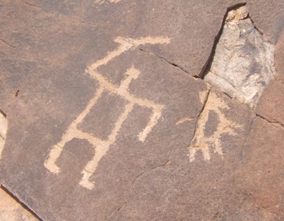
Here is an action scene, the Hunter and Prey...
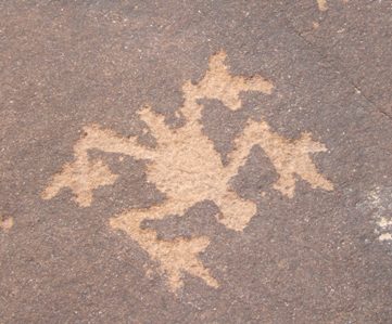
... and here, a lizard?
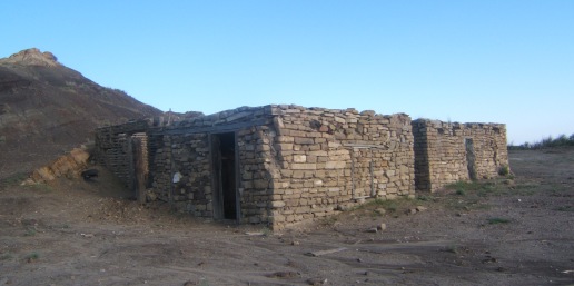
On the way out, a short side trip reveals an abandoned ranch house, at the boundary between BLM land and the Zia Pueblo Reservation.
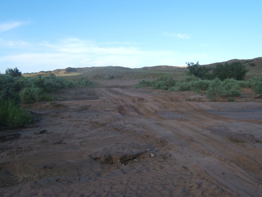
The old ranch house is sited along an arroyo which crosses the main road here. It's a bit muddy from recent rains.
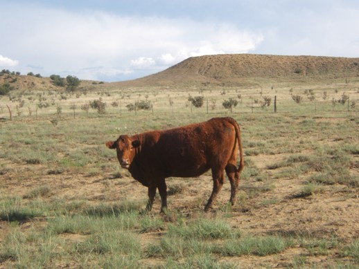
Seismosaurus may be gone, but now the open range is roamed by New Mexico's new dominant megafauna, the beef cow. The fence separates BLM range land from the Zia reservation in the background.
See you next year!